LRO narrow-angle camera products georeference hardware and surface disturbance at the published coordinates for Fra Mauro. Featured-site pages and catalogue links below point to the same releases cited on the Evidence page. All six Apollo sites from orbit lists every crewed zone with LROC featured links in one table.
LROC re-imaging of Fra Mauro ties descent hardware to the published landing ellipse.
The NAC stereo paper’s Figure 1 is an official traverse basemap—EVA paths, stations, and major craters appear on a georeferenced background.
NAC frame tying LM & ALSEP
The `369441main` release resolves Antares, ALSEP, MET tracks, and disturbance patterns across the landing ellipse.
Second Apollo laser array
Apollo 14’s LRRR augments the lunar laser ranging network with an independent deployment geometry from Apollo 11.
Equipment cart trails
MET wheel and boot paths are visible in orbital imagery where lighting favors shallow disturbance contrast.
Lunar laser ranging
Apollo 14 Retroreflector
Earth-Moon distance measurements at millimeter precision.
Deployed 1971-02-05
Selected frames
Documented surface activity during EVA.
NASA
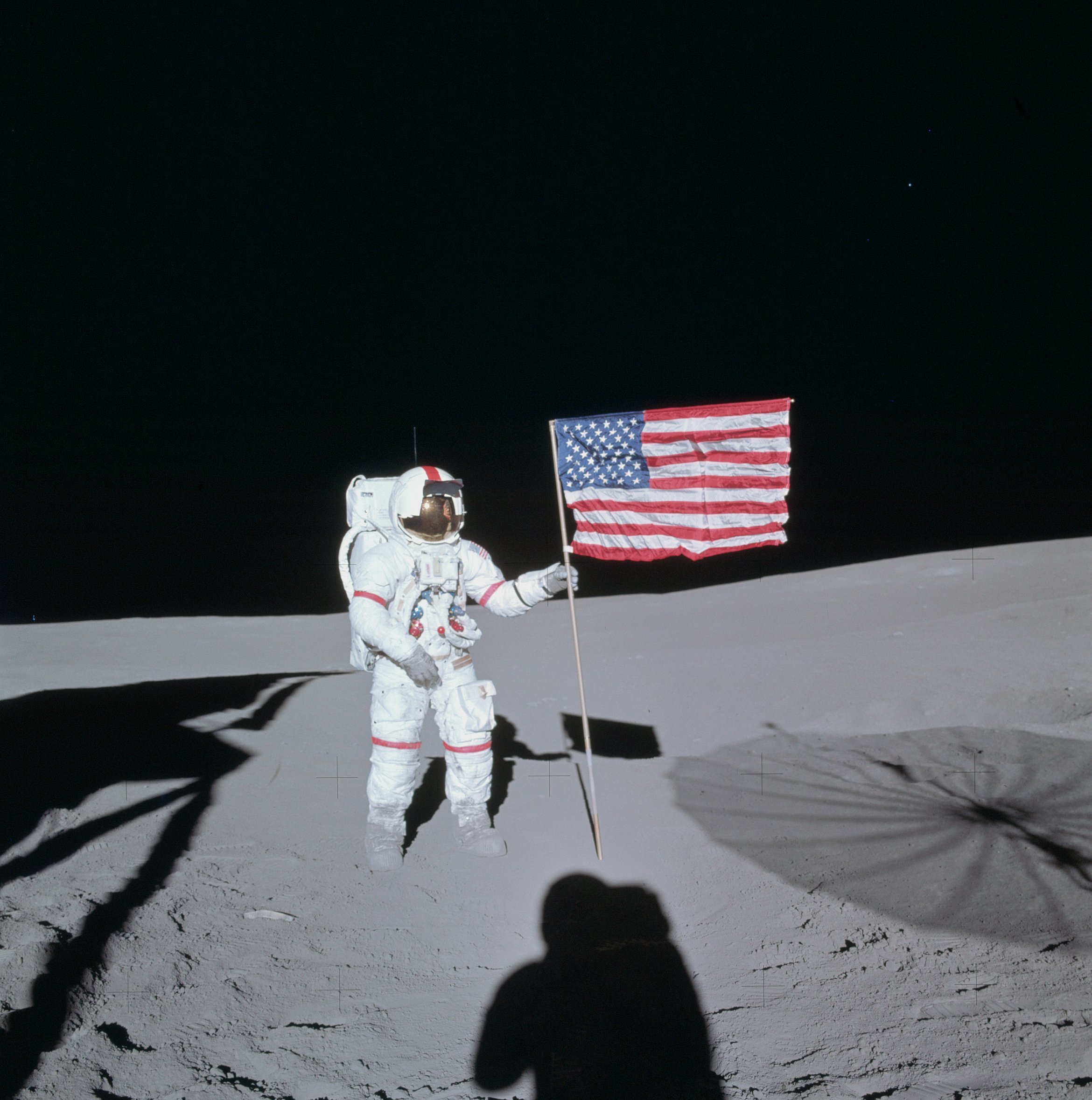
Commander in lunar surface equipment.
NASA
Common questions about evidence for this landing
Factual shortcuts—full citations sit in the sections above and in mission source links.
What do LRO and LROC images show at Fra Mauro?
Published Lunar Reconnaissance Orbiter Camera (LROC) narrow-angle products resolve hardware, experiments, and regolith disturbance at the selenographic coordinates on this page. Use the orbital section above and the official LROC / NASA links under “Official sources” for the featured-site and data-product pages for Apollo 14.
Did Apollo 14 leave a laser-ranging retroreflector on the surface?
Yes. This flight deployed an Apollo laser ranging package still timed by Earth observatories. See the lunar laser ranging callout in the evidence section, then follow NASA and ILRS references from the Sources index and the retroreflector catalogue.
Where can I read how this evidence fits the wider Apollo record?
The How we know page summarizes independent lines of proof. The Evidence catalogue groups LRO imagery, hardware, LLR, photo comparisons, and NASA documents with primary links.
Site imagery
Curated in explorer Site Detail
Apollo 14 — Fra Mauro. Use the explorer’s Site detail tab for the same rasters, or open the official product pages below.
Site map
Site map — traverse layout (LROC post 29, Fra Mauro)
Official LROC NAC stereo release (post 29), Figure 1: curated traverse map with EVA paths, stations, and major features on the Fra Mauro site basemap (NASA/GSFC/ASU/OSU).
NAC landing-site frame — LM *Antares* and ALSEP (369441main release)
NASA/LROC `369441main_lroc_apollo14_lrg` product: narrow-angle view resolving *Antares*, ALSEP, MET/tool cart tracks, and traverse disturbance across the landing ellipse from the first public LROC Apollo 14 release.
After a launch delay, Antares landed in the Fra Mauro highlands—Apollo 13’s original target—deployed ALSEP and a second LRRR, used the MET for equipment transport, and executed a geology traverse toward Cone crater under tight operational rules.
Key achievements
First landing in lunar highlands
Extended surface traverses
Collected very old lunar samples
Surface hardware & experiments
ALSEP
Mobile Equipment Transporter
Laser retroreflector
Timeline highlights
January 31, 1971
Launch after scrub recovery
Saturn V ascent and translunar injection place Kitty Hawk and Antares on path to Fra Mauro.
February 5, 1971
Highlands landing
Powered descent ends in the Fra Mauro formation; crew prepares for dual-EVA geology operations with MET support.
February 5–6, 1971
EVAs toward Cone crater
Traverses sample ejecta and deploy ALSEP plus LRRR; surface photography documents stations along the EVA route.
February 9, 1971
Pacific splashdown
Mission concludes with sample return under standard Apollo recovery and curation flows.
Official sources
Primary portals and data releases for verifying mission-specific claims. Cross-check themes on the Evidence catalogue and the wider How we know overview when you need category-level context.